Nor’easter set to hit East Coast today and continue through weekend
Millions of Americans are gearing up for a rare, multiday nor’easter that is set to start pummeling the Northeast with rain, wind and flooding Friday.
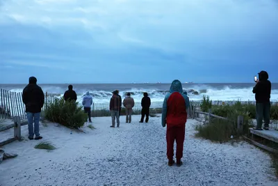
Millions of Americans are gearing up for a rare, multiday nor’easter that is set to start pummeling the Northeast with rain, wind and flooding Friday. Coastal flood alerts are in effect for 33 million people along the East Coast as of Friday morning, affecting states from Virginia to Rhode Island. The storm already brought gusty winds and early flooding across the Eastern Seaboard on Thursday, with rough waves pounding shorelines.
Winds up to 65 mph are forecast, with the strongest winds expected through Saturday night on Long Island in New York and in New England. Heavy rain bands — up to 4 to 6 inches — will hit the area Saturday and into Sunday, and winds will push water onto shore, with 1 to 4 feet of inundation expected. Widespread 1 to 3 inches of rain is possible from the Interstate 95 corridor to the coast. The Jersey Shore, Long Island and coastal New England are the locations likely to see the highest rain totals.
Waves of 10 to 18 feet are expected, with coastal flooding forecasts of 1 to 4 feet depending on the area. The system is expected to intensify as it moves north. It will come onshore around New Jersey. On Friday, the nor’easter will intensify as onshore winds increase from Cape Hatteras, North Carolina, to Cape Cod, Massachusetts. By Saturday, rain will begin from the Jersey Shore to eastern Massachusetts and is expected to last all day.
Saturday will also feature the highest wind potential, with wind gusts that could reach 60 mph in coastal locations. Rain will continue for the Northeast and New England on Sunday, as beaches continue to take a beating from the strong onshore winds. The storm will still be spinning just off the coast Monday. While winds will be weaker, rain and beach erosion will continue. Winds are expected to lead to travel delays and power outages into Monday.
Southeast New England faces the highest risk of power outages because of the strongest wind potential and top-heavy trees with leaves still on them. Areas of New Jersey were already lashed by rough surf Friday morning, with videos showing waves crashing along the shore. “The waves, the wave actions, the way it comes in, it just takes everything in its path,” said Mike Jones, the emergency management director for Upper Township, New Jersey.
“And there’s really no way to stop Mother Nature.” A full moon Saturday night is also expected to lift tides up to 5 to 6 inches. One New Jersey resident told NBC News that to prepare for this weekend’s nor’easter, she closed up her whole house. Outside Washington, abnormally high tides were seen along the Potomac River, inundating roads with floodwaters and leaving a popular Maryland music festival practically underwater.
The first day of events was canceled in advance. In North Carolina, winds greater than 50 mph have been recorded. A video showed a car in the state nearly swept into the ocean before a tow truck saved it. Elsewhere in the region, emergency preparedness crews are cutting down trees and readying sandbags. Officials have warned of flooding in neighborhoods. Hurricane Nolo barreling toward Hawaii’s Big Island Meanwhile, Hurricane Nolo is barreling toward Hawaii with 80 mph winds.
It is a Category 1 storm and is moving north at 5 mph. At some point over the weekend, it is expected to become a major hurricane, upgraded to a Category 3 or 4. The storm is forecast to stay south of Hawaii, but the islands will still feel Nolo’s wrath. Heavy rainfall — up to 30 inches on the Big Island — and intense winds are already affecting the state. People in Hawaii are preparing for the worst, expecting catastrophic flooding.
Just last month, Hurricane Lala brought destruction to Hawaii’s Big Island, damaging more than 100 homes and stranding people without water and power. In addition to dangerous surf and damaging winds, mudslides are a major concern in Hawaii. As of Thursday night, stores were sold out of generators and gas cans. Shops were boarded up and blocked with sandbags. Schools were let out Thursday to give residents more time to prepare for the storm’s effects.
Nolo is expected to reach full strength sometime Friday night.